
Kotor Bay, Montenegro
We woke up to the sun shining brightly with a beautiful day ahead of us. We had a quick breakfast of Nutella on bread (bread tucked into napkins from the restaurant the night before...we really needed to stop at a grocery store), and went to talk to Uros, the owner of our campsite Camping Zlokovic. He offered to drive us down to Kamenari to get on the ferry there, thereby cutting our travel time to Kotor (pronounced koh-tour) from around 40 minutes via bus to around 25 or so. We took the ferry for free (I think humans on foot don't have pay, but humans in vehicles do), a short jaunt of maybe 5 minutes across the neck of the bay so that we were closer to Kotor. The Bay of Kotor is sort of bow-tie shaped, and Kotor lies in the far southeast part of the bow tie. It doesn't seem that far away on a map, but it takes a good deal of time to drive along the coast around to Kotor.

Kotor is located at the bottom right.
We opted not to take the RV to Kotor. I was nervous about narrow roads and lack of parking. The roads on the way to Kotor are actually a fair width, but I don't know that we would have had a good place to park an RV. Once you go past Kotor, though, the roads become really, really narrow.

Our Lady of the Rocks Island
Sorry about the grainy photo, but this was taken in a moving bus at sunset. Our Lady of the Rocks Island is a manmade island in the middle of the Bay of Kotor (or Boka for short) right off the coast from Perast. There is a natural island called Sveti ?or?e Island next to it. The history behind Our Lady island is interesting. According to legend, on July 22, 1452, the icon of Madonnna and Child was scene at this location on a rock in the bay. After that, seamen kept an oath that after each successful voyage, they would bring a rock to the bay. It was created by a combination of rocks and sinking old and/or seized ships with rocks. This tradition is continued to this day, and the island continues to get larger. There is a Roman Catholic Church of Our Lady of the Rocks on the island, as well as a museum and gift shop. We didn't have time to take a boat out to the island, but we would have liked to!

Crkva Ro?enja Bogorodice, a beautiful church we saw during our taxi ride to Kotor
Once across the neck on the ferry (we ferried over with cars, vans, and motorcycles!), it was taking forever waiting for a bus. We grabbed a taxi to take us the 12 km (~7.5 miles) to Kotor, which cost 10 euros. It was quite an interesting ride - zipping through typical tiny European roads in a tiny car. Our driver dropped us off right in front of old town Kotor, which was also the destination of many other tourists. I'm so glad we went in October - there were so many tourists at this time of year, I couldn't imagine what it would be like in the high season summer months.

View of Old Town Kotor
After grabbing a free site map from the tourist booth out front, we entered the city gates. That bread and Nutella for breakfast wasn't holding us over well, so gelato it was. We decided to hike to the top of the fortress to the Castle of St. John first thing - get the sweaty, tiring, and exciting part out of the way first. It cost us 3 euros (which is about $3.38 USD at the time of this writing) each to make the climb. And holy smokes, a climb it was.

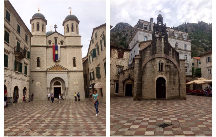
Saint Nicolas Church (l) and Saint Luke Church, both on the Piazza Greca in Old Town Kotor
Be prepared for a heck of a descent. They have a map showing the "easy", "medium", and "difficult" hikes. To get to the Castle of St. John at the top, you have to go on all 3 types. You will have to be in fair shape to make this journey - I am by no means in shape, but I made it. We took our jolly good time heading up, between stopping for a breathing break and taking a thousand photos on the way up. The lady at the entrance said it takes about 20 minutes to get up to the Church of Our Lady Remedy and about 45 minutes to get to the top. I think we took a little longer for both of these parts, but a lot of that was because we wanted to explore every square inch of the ancient walls and ruins. All in all, it took us 1 hour 45 minutes to get to the top. I'm not kidding when I say we stopped a lot for photos. I would highly suggest a bottle of water; we bought a bottle about 1/3 of the way up for 1 euro (around $1.38 at the time of this writing).

Kotor City Walls climb

Kotor City Walls climb
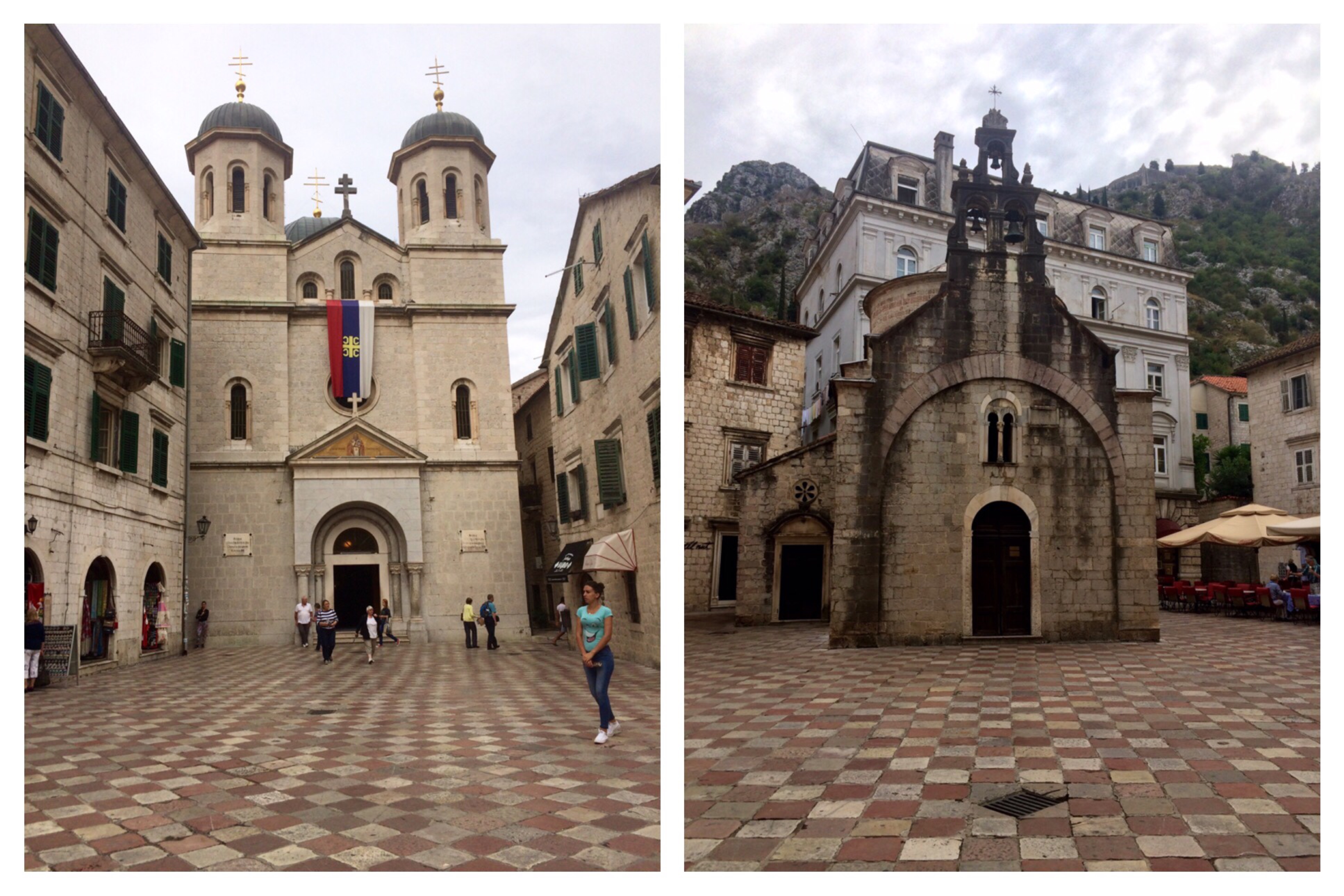
The first destination you come to is the Church of Our Lady Remedy, which is a tiny little church built in 1518 with a heck of a spot on the side of the hill about 1/3 of the way up. Many of the photos you see of Old Town Kotor are taken from right above the church, which is a spectacular view. Exhibit A:

View of Church of Our Lady of Remedy and Old Town Kotor
The climb is a pathway that includes both stair and ramp options. The stair is not even, and there is sometimes not a railing. The ramp is mostly solidly packed stoned, but there are some instances where it is loose. There are numerous switchbacks. I'm not sure I could even give you a number on how many.

Old Town Kotor city walls climb. I hope this conveys just how steep it was in some areas.
Once up to the top of the wall, you come across many fortification strongholds in various states of disrepair. Be careful where you step, but we highly recommend exploring! It's really neat to examine the spaces and picture guards on top of this wall with one heck of a view. If you peak around behind the walls to the mountains and valleys below, you'll even see some foundations of ancient houses.

Old Town Kotor city walls and fortifications

Beauty growing from the walls
The fortifications themselves maintain an array of different military architecture, including Austrian, Illyrian, Venetian, and Byzantine. Castle of San Giovanni, at 280 meters (~919 feet) tall, sits at the top of the mountain and was already fortified around the 6th century. Throughout the years, the fortification has been owned and/ occupied by several different powers - the Byzantines, the Venetians, the Ottomans, the French, the Russians, the British, the Austrians, and finally Montenegro (which only in 2006 became a new country). It has been damaged by 3 earthquakes throughout history, including in 1563, 1667, and 1979. Three gates allow access into the city - the Sea Gate, the River Gate, and the Gurdic Gate. The outer wall is a total of 4.5 kilometers (~2.8 miles) long. The thickness of the walls is anywhere from 2 meters (~6.6 feet) thick to 16 meters (~52.5 feet) thick and is 20 meters (~65.6 feet) at its highest. It made it on the World Heritage List in 1979, and there was a rehabilitation of the entire fortress in 2003.

It's a long way down from the top.
After climbing to the top, we made our way down to one of the best restaurants in Kotor called Galion. It sits out in the bay with a great view of old town and the rest of the surroundings. We had delicious food and great service, which had us prepared to keep up our explorations in old town Kotor in the afternoon.

Delicious food from Galion...nomnomnom.
We spent the afternoon exploring all the ancient buildings we could along each tiny and crooked path through the city. It also happened to be a great place to get gifts for the family, so we did that as well. One neat fact about Kotor: this city loves its cats. A lot. So much so that there is a Cats Museum. We didn't have time to go, but we did see the tons of cat trinkets that you could buy around Old Town. Cats have become the unofficial mascot of Kotor, and there are stray cats everywhere.

Old Town Kotor

Old Town Kotor

Cathedral of Saint Tryphon in Old Town Kotor
We decided to stay the night at Camp Zlokovic since it as getting so late. We had heard that the drive from Kotor to Dubrovnik was quite beautiful, so we wanted to see that in the day time. Up early the next day, we started what became a tour of many different Game of Thrones filming locations.

Old Town Kotor, the city that loves its cats
Leave a Comment